« Nevada | Main | Southern Oregon »
July 14, 2005
Nothern California
When you leave Reno, Nevada on Interstate 80, the way to California is over Donner Pass. The elevation at Reno is 4,490 and at the pass is 7,912. That certainly put the truck to the test with a rise of 3,500. As important, the downhill slope into California begins with a sign – “40 miles downgrade.” There are about 33 truck advisory signs along the descent. We were glad when we got down into the valley and on to Sacramento.
 The next day we went downtown and took a tour of the Capital buildings. We didn’t see Arnold (Schwartzenager) although he was apparently in his office. Bernie picked a fallen orange from one of the many trees in the grounds (it was excellent). There are dozens of huge redwoods, pine, cedar and fir, as well as many other imported trees and shrubs and lots of flower beds.
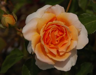
As you can see we also take the time to smell the roses.
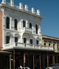
Old Sacramento is a four block section, on the river and was the commercial district during the gold rush. It has been redeveloped with museums, shops and restaurants. One of these is the California State Railroad Museum where we spent one afternoon among huge old restored engines and other rolling stock. When we left this building we went down to the Sacramento river and were able to wander around an original river paddle wheeler that is now used for parties and business meetings.
After three days we started north into the central valley to the town of Chico. All along the road, on both sides and in the median are masses of wonderful white, red and pink oleander bushes. After the desert of Nevada, the barren Sierra Nevada mountains and the traffic congestion of Sacramento, Chico is a wonderful oasis of green lawns and huge trees.
We arrived on Friday, the 24th in time to get set up and then go downtown for the evening “Annual Parade of Lights”, a community celebration. The participants and floats – among them nursery school children, Spanish horses, the fire department, a local bar - were decorated with lights. Saturday morning we went to the Farmer’s Market where we stocked up on strawberries, vegetables and fresh baking. The county certifies that the produce being sold has all been grown by the seller.
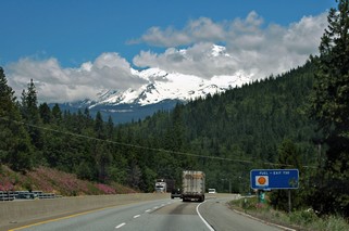
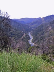 After the market, we headed up into the Sierra Nevada’s to the town of Keddie. It’s a 70 mile drive each way and most of it, on the way there, is up the Feather River Canyon. The highway is built into the side of the mountains and at some points the valley, right at the edge of the road, is close to 1,000 feet down . In this picture the valley is wider than during most of the drive.
It is spectacular!
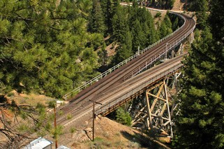 But Keddie is also known to rail fans as the place where the track exits from a tunnel and “Y”s immediately on bridges. The mountains are so close together and the sides are so steep that there isn’t any flat land to build the junctions - thus the bridges.
After getting an oil and filter change on Monday (yes, we do keep the maintenance done on the truck since it is so important to us) we headed up the valley on Tuesday, the 28th, This area is filled with orchards, vineyards, all kinds of berries, potatoes and as we went north, huge herds of cattle.
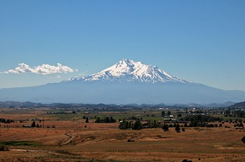
 Arriving from the south, you catch glimpses of Mount Shasta as you head into the mountains. We had no idea that the second highest mountain in North America was in the area we were going to. It is 14,162 feet high. We camped outside the town of Weed for 3 nights and were able to tour this dramatic mountain. You can drive up to the 6,900 feet height on a good paved road, but very twisting and quite steep. From there, trails go up to the glacier and many people were starting to make the climb. We met one young man who had climbed to the base camp, which is on the glacier, the day before and that morning had climbed the rest of the way to the top. He then snowboarded down the mountain from the top to about 1/2 mile from where we were parked and it took him only 50 minutes. He certainly was fit.
Mount Shasta dominates everything around and as we left on Friday morning July 1st, to go north into Oregon, we had some of the best views of her.
Now, it’s up the long haul over Siskiyou pass and into Oregon.
Posted by Ross at July 14, 2005 11:02 AM