« Prince Edward Island 2006 - Part I | Main | New Brunswick 2006 - Sussex Balloon Festival. »
September 10, 2006
Prince Edward Island 2006 - Part II
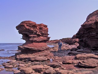
If you look at Prince Edward Island on a map, you will see that it is crescent shaped and nestles at the bottom of the Gulf of St. Lawrence. The north west point is called North Cape and is rugged red rock sculpted by the ocean. Twice a day the tide moves in and out carving the landscape.
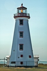
The North Cape lighthouse was built in 1866 and is one of 50 lining the coast, although only about half are fully operational now.
On the south eastern point on the island, at Cape Bear lighthouse, Thomas Bartlett was the first to hear the Titanic’s distress signal as it sank off Newfoundland.
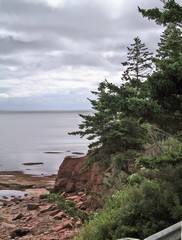
The south east coast still has the red soil, which is caused by iron that has rusted, but the waves do not seem to have the same power and thus the sculptures are nowhere as dramatic.
In a province of such beauty, it sounds strange to say, but after awhile, one red cliff starts to look like another.
We stayed at St. Peters, in the north east of the island, while we toured the east side. We went through road construction (a new bridge) at the Midgell river. The following day we found out that the road had been closed and we had missed a 17 km, dirt road detour by a couple of hours.
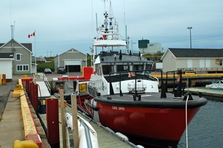 At Souris (pronounced Soo-ree) we were fortunate to meet a member of the Coast Guard Search and Rescue. Of course it didn’t hurt that he was a rail fan like Ross is. Souris is one of their bases in PEI and we were given a full tour of the cutter. The bridge is so full of instrumentation that it is tight quarters to move around. They have all the equipment on board to help stabalize and tow vessels in distress and to retrieve people from the ocean. Most interesting.
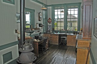
At its peak, the PEI railway system had 121 stations, along 400 kilometres of track. It connected almost every village on the island and ended at the Elmira station in the north east. The station has its original furnishings and is very well maintained. There has been no railroad on PEI for around 20 years, but the Confederation trail follows this abandoned rail line. It’s a wonderful bicycling and hiking path that traverses the 280 kilometre-long province. The trail includes a network of unsurfaced paths branching from the interior to the coastal areas. We hiked the trail on a number of occasions as it went right past both campgrounds we stayed at.
We didn’t spend much time in Summerside or Charlottetown but did go in one rainy day to tour Province House. This was the site of meetings that led to Canada’s confederation in 1867 and the Provincial Legislature still meets there. It’s worth a visit.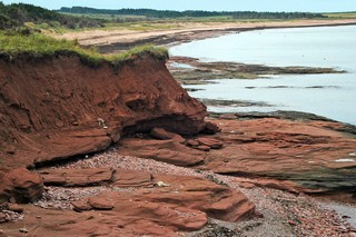
We decided that one business we would like to have on the island would be riding mower sales & service. Generally the houses are modest but the lawns are HUGE and every one is cut beautifully and well maintained.
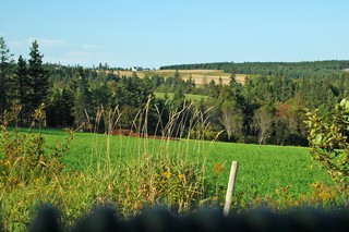
Rugged coast lines with sandy beaches, rolling hills, fields and fields of potatoes, woodlands and long bays. It’s a gentle island and we were always made to feel welcome.
We’re headed to Sussex, New Brunswick for the balloon festival Sept 8, 9 & 10th.
Pictures from there in the next report.
Bernie & Ross
Posted by Bernice at September 10, 2006 11:59 AM
Comments
I can't thank you enough for including me in your travel log. I always look forward to your latest venture. Since I have not been down east since I was a little tyke it is most interesting to see what you have and how beautiful Canada really is. I remember swimming at Kennebunk Beach. quite beautiful if you get a chance to go there. Also a lovely B&B called Duncan Hines.
That was a real stunner. Till then. Louise
Posted by: Louise Fell at September 24, 2006 11:31 AM