« Nothern Oregon | Main | Northern Washington »
July 28, 2005
Southern Washington
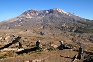
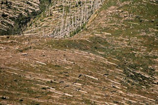
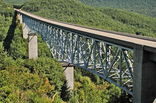
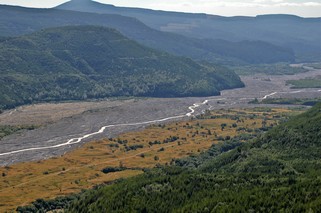
Mount St. Helens – a National Volcanic Monument. On May 18, 1980 just after 8:30 AM, a magnitude 5 earthquake, centered beneath the north flank, shook the mountain and triggered an avalanche, and the whole north side of the summit started to fall away. In minutes, the 9,677 foot summit was reduced by 1,300 feet. The cloud from the eruption rose 12 miles into the atmosphere. 500 million cubic yards of molten rock were blasted from the mountain and plunged into Spirit Lake and the Toutle River at speeds of 150 mph. An enormous blast cloud tore out of the mountain and surged at several hundred miles per hour, hugging the ground and climbed over four major ridges and valleys. It levelled 230 square miles of prime forest and killed almost everything in its path. This whole sequence took less than 5 minutes. In the next hours, ash and pumice flows swept out of the crater and down the mountain. This was followed by mud flows of ash, fine rock mixed with snow and ice which raced down rivers, sweeping bridges and homes away. Spirit Lake’s water level was raised 200 feet. The Toutle River valley was filled with rock and debris to depths of 300 feet, completely covering the original road to the mountain. 57 people died and an estimated 1.5 million animals. A new road has been built with 19 new bridges (the one pictured above is 2600 feet long), this time high up on the sides of the approaching mountains. The land is gradually starting to recover, but some areas closest to the blast have only bits of lichen and grass even yet. Massive reforestation efforts started immediately – Weyerhauser lost 85,000 acres of trees. The National Monument has however been left to natural recovery.
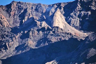
And the mountain is once again stirring. Since March of this year, a lava cone inside the crater (see second picture) has been growing at about 5 feet per day.
Perhaps, because this eruption happened in the very recent past, rather than thousands of years ago like so many other things we have seen, it had a very moving effect on both of us. It is very sobering and humbling to realize the awesome power of nature.
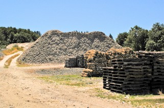
The next day, July 20th, we went to the Washington coast, to Long Beach Peninsula. Going south on the coast from Raymond we went into some of the small villages where oysters were being harvested. There are huge piles of white oyster shells that reminded us of snow – but it was about 25C.
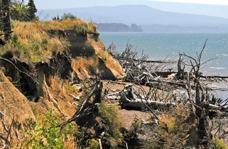
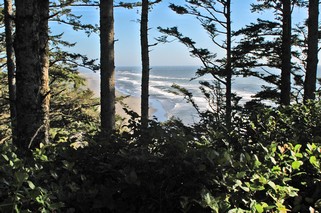
We continued south on a more local road, right beside the ocean. Unfortunately, most of the time you can’t see much, as the trees have grown up between the road and the water. We did however, find an open area and parked to have lunch. Bernie often packs salads so that we are not dependent on finding a restaurant. We have a plug-in cooler that we take with us when we are on a day of sightseeing. The coast is very eroded, with many trees that have been undermined by the surf and fallen to the beach.
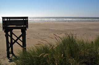
Long Beach Peninsula is a 28 mile spit of land running north from the mouth of the Columbia River parallel to the shore we had just travelled south on. It is known for its oyster farming and its hard sand beaches. There is a wonderful 2,300 ft boardwalk along part of it. In this picture, those tiny dots at the edge of the water are really people, so you can see how huge the beach is. It is also a favourite for kite flying, and in many places the cars are driven right down to the waters edge. Bernie walked way out on the sand so that she could actually stand in the Pacific Ocean.
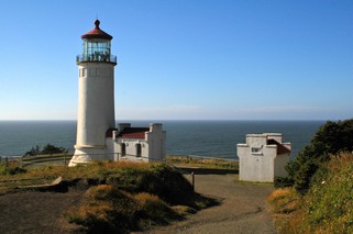
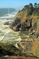
South of Long Beach, at the mouth of the Columbia River stand two lighthouses, North Head and Cape Disappointment. We climbed to the top of North Head. You can see how rugged the coast is looking north. It’s hard to believe that just a few miles further up is Long Beach. Then you look south and you can see the long sand spit of beach that has been created by the flow of the Columbia River.
We came back to our campground at Toledo, WA following the north shore of the Columbia River. A long day, but worth it.
Now we are heading up into northern Washington.
Ross & Bernie
Posted by Ross at July 28, 2005 09:03 AM